Pangaea
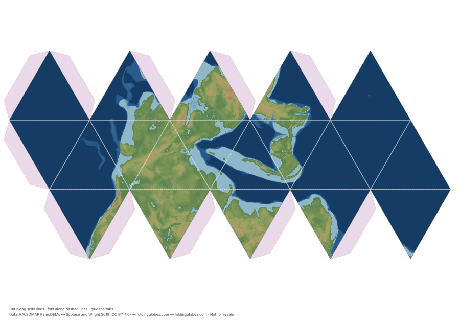
Earth 250 million years ago: one supercontinent, one world ocean — fold the planet the dinosaurs' ancestors walked.
Drag to spin — this is what yours looks like folded.
About this globe
The world at the Permo-Triassic boundary, 250 million years ago, from the PALEOMAP paleo-elevation models: every modern continent fused into the supercontinent Pangaea, wrapped by the world-ocean Panthalassa, with the Tethys Sea biting in from the east.
Every landmass on your other globes is in here somewhere — India tucked against Antarctica, and the Atlantic simply doesn't exist yet. It folds up strange and familiar at once.
How the data was captured
Reconstructed by paleogeographer Christopher Scotese by rewinding plate motions recorded in seafloor magnetism and matching rock formations, then estimating ancient elevations from geology; rendered by us from the published elevation grids.
Data: PALEOMAP PaleoDEMs — Scotese and Wright 2018 (CC BY 4.0) →
Download free — pick your paper size
Print at 100% scale. Cut along solid lines, fold along dashed lines, glue the tabs. Your PDF can take up to a minute to prepare — hang tight after clicking.
In the US? Print the A4 file and choose “fit to page” — it scales cleanly onto Letter paper.
Sharing this globe?
Free for personal use, classrooms, and gifts — not for resale. If you post it on your site or share it online, please credit Folding Globes with a link. Copy-paste blurb:
"Pangaea" folding paper globe — free from Folding Globes, https://foldingglobes.com/globes/pangaea · Data: PALEOMAP PaleoDEMs — Scotese and Wright 2018 (CC BY 4.0)
Make it yours
Every paid shape also lets you pin your own places on the map.